Marapi (Western Sumatra, Indonesia): Explosive activity continues. Volcanic Ash Advisory Center (VAAC) Darwin warned about a volcanic ash plume that rose up to estimated 20000 ft (6100 m) altitude or flight level 200 .
The full report is as follows: VA TO FL200 LAST REPORTED AT 02/0450Z OBS VA DTG:02/1150Z to 20000 ft (6100 m)
Dukono (Halmahera): Explosive activity continues. Volcanic Ash Advisory Center (VAAC) Darwin warned about a volcanic ash plume that rose up to estimated 8000 ft (2400 m) altitude or flight level 080 and is moving at 05 kts in N direction.
The full report is as follows: VA TO FL080 OBS AT 02/1640Z EXT NNW EST VA DTG:02/1640Z to 8000 ft (2400 m)
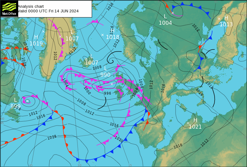
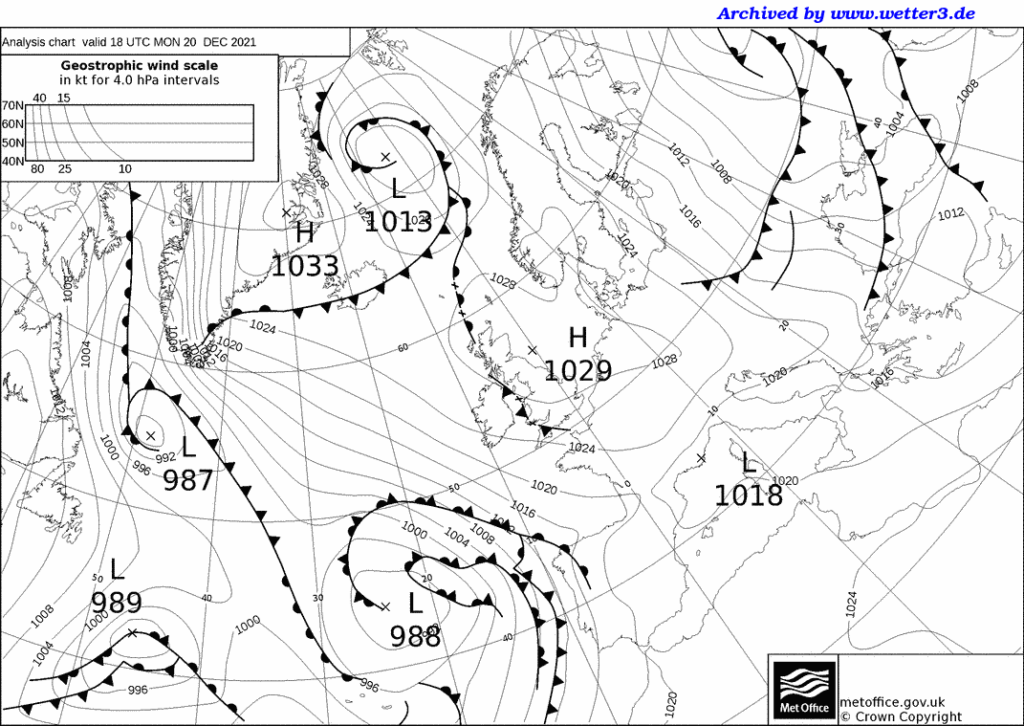
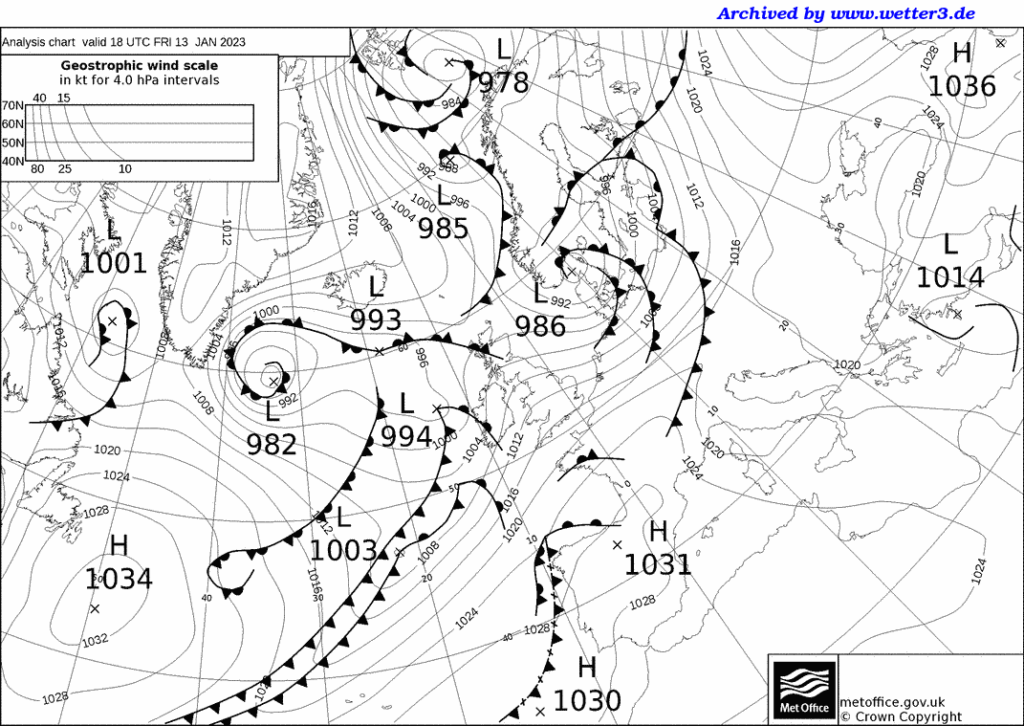
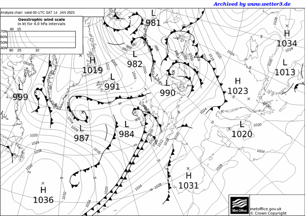
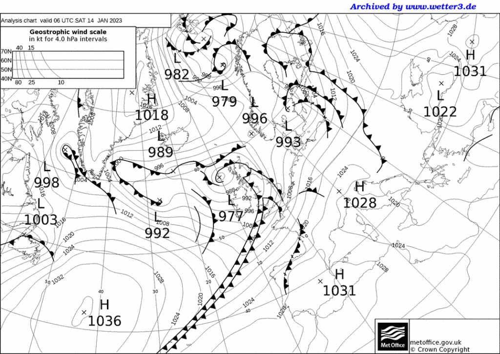
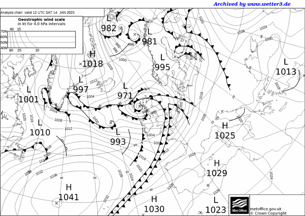
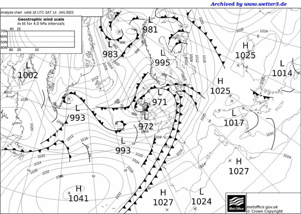
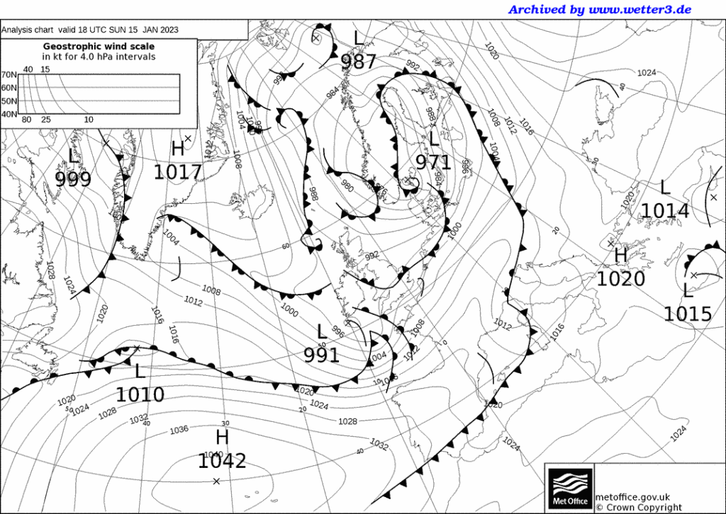
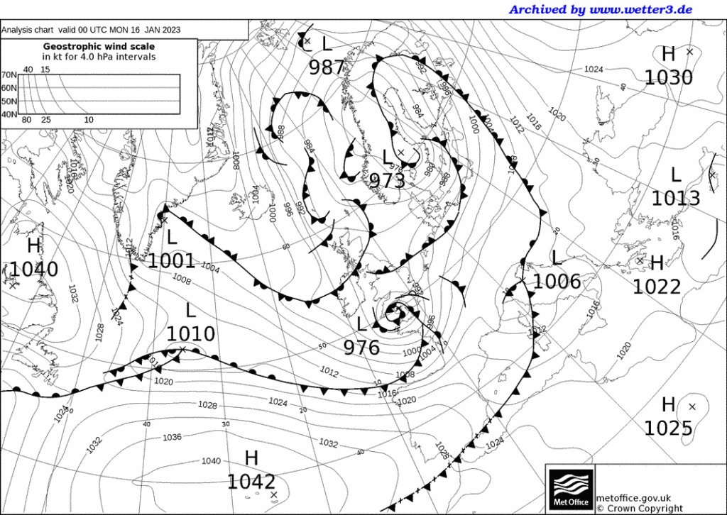
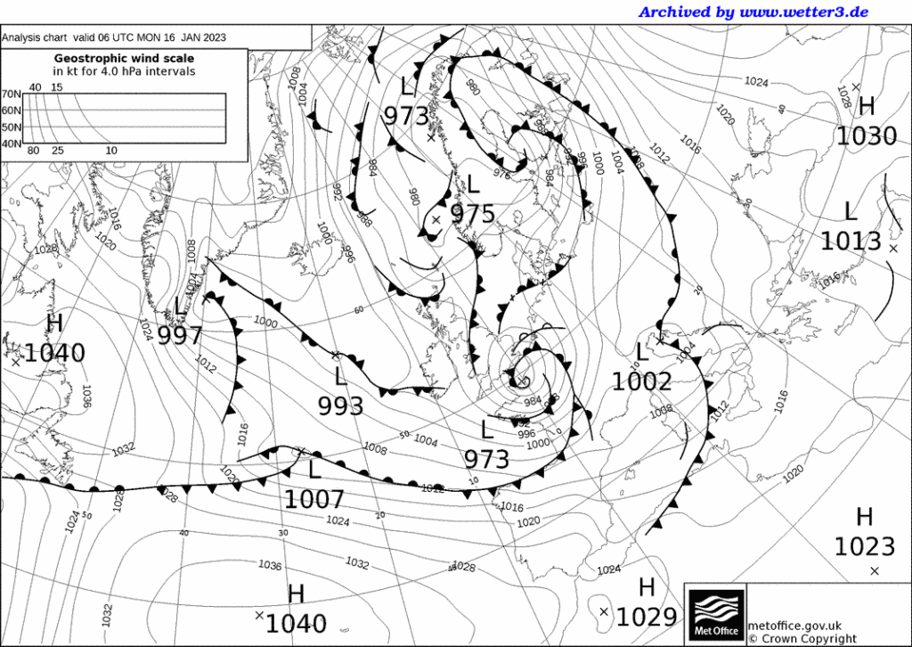
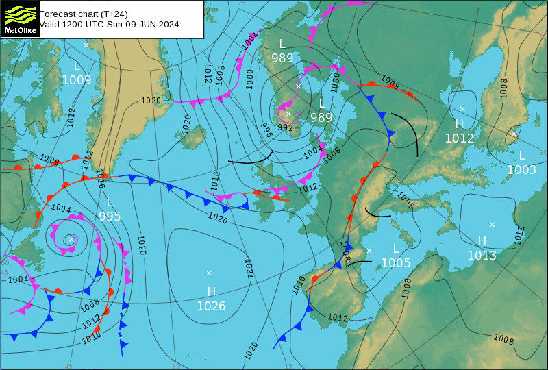
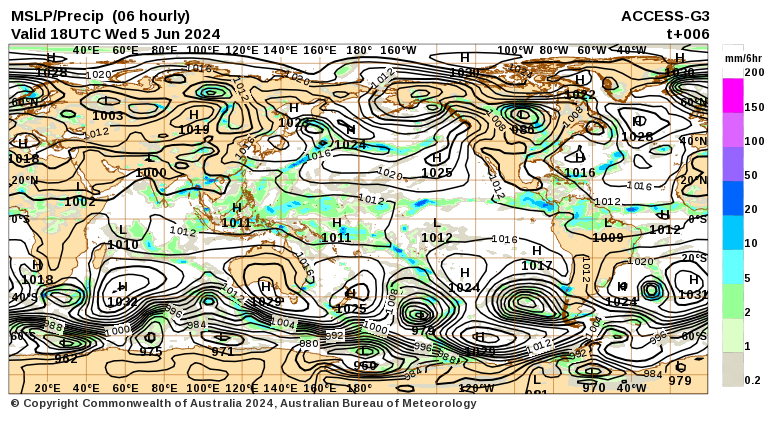
This dual under Greenland and Newfoundlans High-1029, and High-1030 are Marapi/Dukono. I have no idea which is which at the moment but findin out things like this makes me feel liek I know what I am doing and gives me the confidence to continue, completely in the dark excet that I think I am guded by holy spririt.
I can assure you that if iI can do it anyone else can too all I did was ask how these things work. Believe me I am more surprised than you that Jehovah answered me. I assume that I have to get busy publishing this stuff.
NOT that I want payment but these days nobody is interested untill whoever they wish to be interested in gets rich and famous. Believe me I do not desire fame. I am just trying to hide under a rock whist the power of god passes. I don’t even want to look!
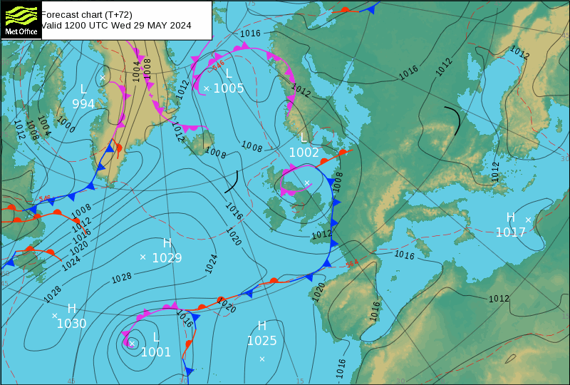
There is no reaon to believe that these things do not occur it is just that in all the years I have followed these North Atlantic charts, I had never noticed one. Now not only have I noticed but somehow the hand of God handed me the answer to which volcanoes they are.
Thank you Jehovah.
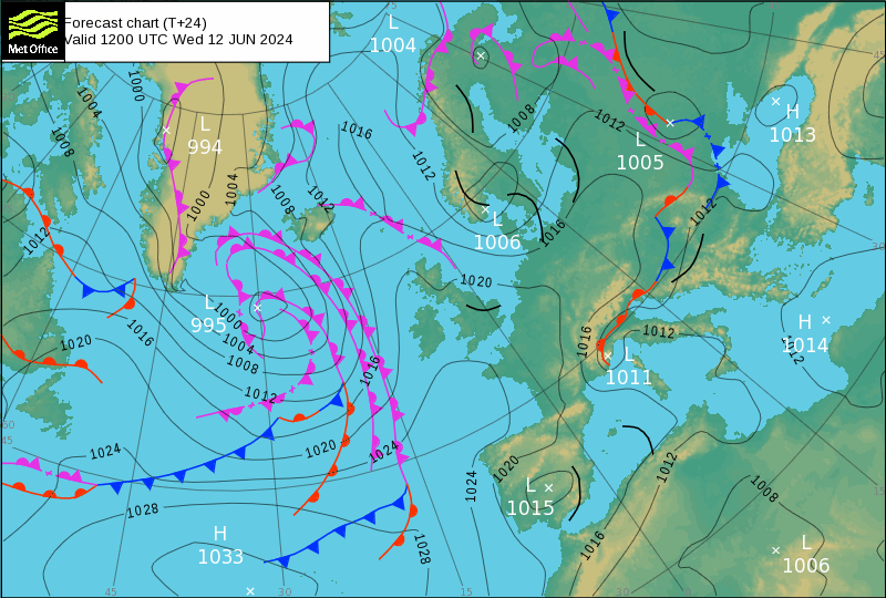
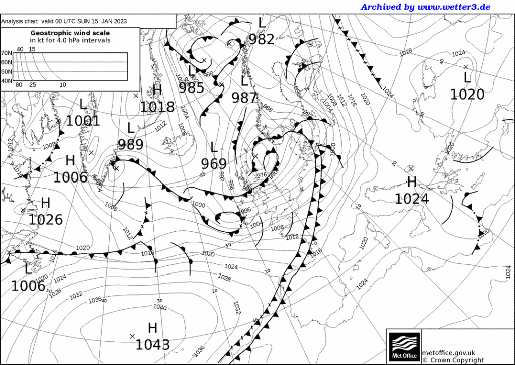
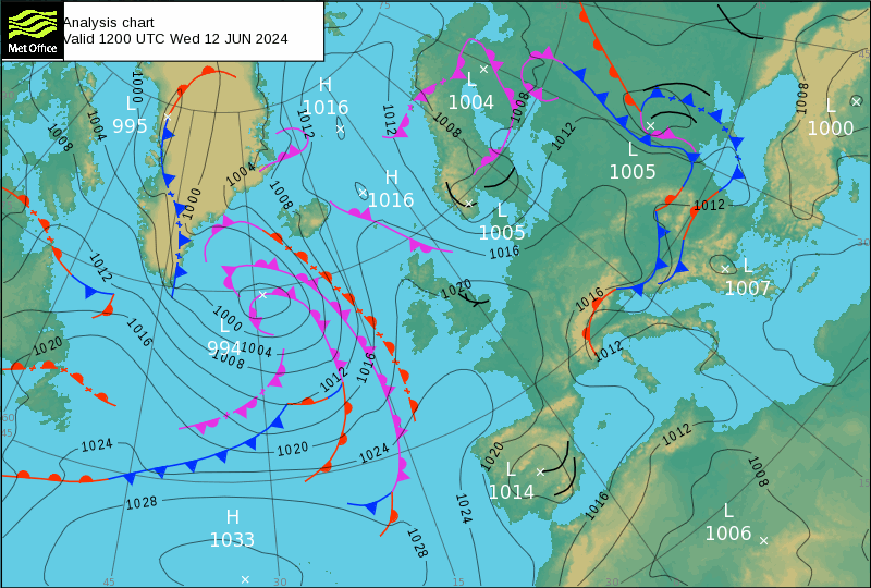
Abother dua,l probably the same one, suddenly it is showering Duals. I was not paying full attention, a poor habit, I was just waiting for the next large quake as the weather had warmed enough to alert my psyche. Old and ill, it does that automatically these days.
I have nothing better to do. I struck me as I was catching up on last evening’s charts there had been a large eruption.
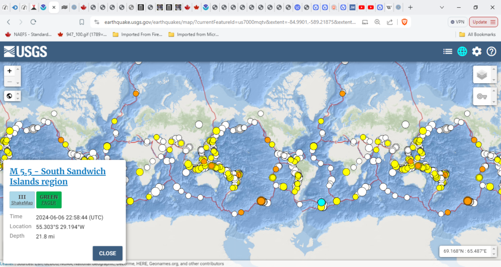
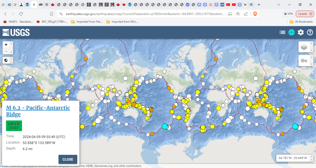
Three earthquakes too at least, all in the same region:
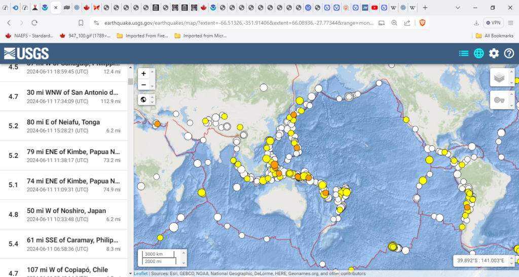
Nothing major a 5.8M and a 5.7M. Another 5.7M on the 9th with this:
6.2M. Pacific-Antarctic Ridge 2024-06-09 09:55:49 (UTC) With Venus Mercury Mars and Saturn aligning, I’d expected more.
Ibu (Halmahera, Indonesia): Explosive activity continues. Plume estimated 7000 ft (2100 m) altitude or flight level 070 .
Lewotobi (Flores): Near-frequent vulcanian-type explosions plumes 10,000 ft (3,000 m)-12,000 ft (3,700 m)
Semeru (East Java, Indonesia): Plume that rose up to estimated 15000 ft (4600 m) altitude or flight level 150.
Dukono (Halmahera): Plume estimated 8000 ft (2400 m) altitude or flight level 080.
Not spectacular but this is on the Atlantic: Sangay (Ecuador): Explosive activity continues. Plume estimated 22000 ft (6700 m)
Yesterday:
Marapi (Western Sumatra, Indonesia): Explosive activity continues. Plume estimated 14000 ft (4300 m) Dukono (Halmahera): (12 Jun) Explosive activity continues. Plume estimated 9000 ft (2700 m)
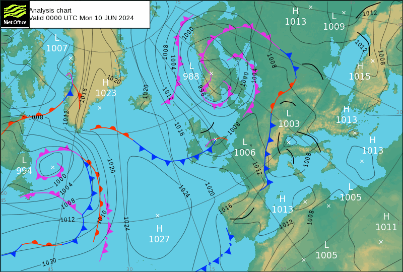
So that was the dual in the Norwegan Sea between Greenland and Norway (I always confuse the Norwegian Sea with the North Sea.)
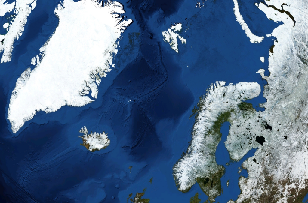
This is where the weather turns over. Greenland is mostly desert with a very low population density of 56,583. Iceland is 376,248 but thriving, Norway
This is where the weather turns over. Greenland is mostly desert with a very low population density of 56,583. Iceland is 376,248 but thriving, Norway 5,475,240 and Sweden 10,555,448. I wonder how that compares to the USA Strangely the region does not appear to be a target for refugees. Middling to Arctic, I wonder why.
Washington, D.C.: 10,984.43 people per square mile. I am guessing hqalf of them are Jewish politicians. Good job they are mostly on holiday. https://www.statista.com/statistics/183588/population-density-in-the-federal-states-of-the-us/
This may be the best site for invrdyigating recently archived volcano data https://watchers.news/2024/06/13/the-weekly-volcanic-activity-report-june-5-11-2024/